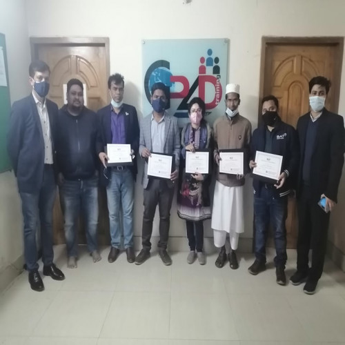
BSGI GIS Training Certificate Giving Ceremony (3rd Batch
-
Date: 2022-01-27
BSGI GIS Training Certificate Giving Ceremony
BSGI successfully completed its 3rd training on GIS for professionals on 27 January 2022 at Dhaka. The duration of the training was five days from 23-27 January 2022.
Bangladesh Society of Geoinformatics (BSGI) is a Professional Association of GIS, Remote Sensing, and Photogrammetric Professionals in Bangladesh and abroad. BSGI aims to build capacity on Geo-informatics among governmental and non-governmental agencies and to guide and assist the proliferation of Geo-information technology and the sharing of ideas, information, knowledge among users, professionals, and institutions.
Participants from different government and multinational companies were attended training program. There are ten (10) modules and seven (07) individual exercises in the training session. Also, from the training program participants learn about the fundamentals of GIS, familiarize themselves with ArcGIS components, the benefit of Geospatial Data application of GIS, challenges, and future of GIS uses. Participants also learn different map projection systems, GIS database preparation such as digitized scan maps or high-resolution satellite images or other source maps to develop land-use databases or social facilities databases as necessary.
In the certificate giving ceremony BSGI Treasurer Dr. Md Golam Mahboob handover certificates to the participants. Dr. Mahboob requested to all participants to continue practice and asked to use of GIS in their professional life.
In the certificate giving ceremony BSGI Executive Board Member Mr. SS Biddya Baron Sarker was present along with Dr. Mahboob and the training instructor.
Back